The Maine Seaweed Council wishes to thank Commissioner Keliher, Bill DeVoe and Nico Popoff for their support and expertise in finally making the online resource to report all seaweed harvesting by Zone/Sector.
How To Access Sector Information for Seaweed Harvesting & Landings Reports
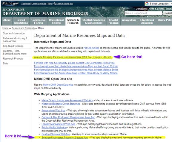
To go to the Department of Marine Resources Maps and Data page
NOTE: If you haven’t used DMR maps before, please go to the Guide first!
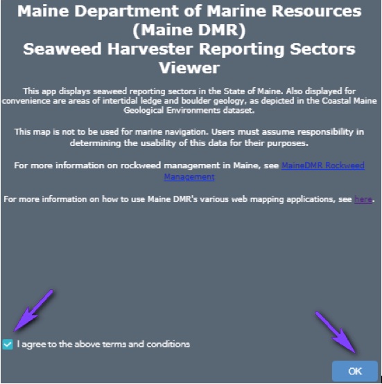
When you first go to the Sector Map, this pop-up window appears. Read the text, Click on “Agree” box, then OK.
When you first open the sector map, it will look like this.
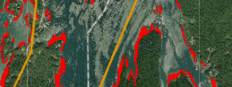
Many of us would rather see a NOAA nautical chart, and be able to remove the red lines. Easy!
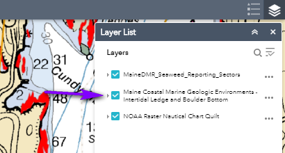
Access the Layers List that will enable you to use the NOAA chart (most familiar to many of us), and turn the red lines on or off, click to the Layers icon at the top right.
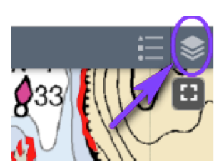
You can turn the red lines for Intertidal Ledge etc. ON or Off by checking or un-checking this box in the layers list.
Navigate to any area on the chart, click on it, and the Sector Information opens in a pop-up window. (The lines for the sectors within a zone show.)
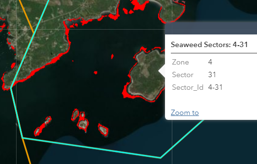
Harvesting should be reported to Landings as 4-31.
(Zone 4, Sector 31)
You could also supply additional
information
e.g. West side of which island.